Development of a digital accessibility tool for balanced spatial and transport planning (GOAT 3.0)

General Description
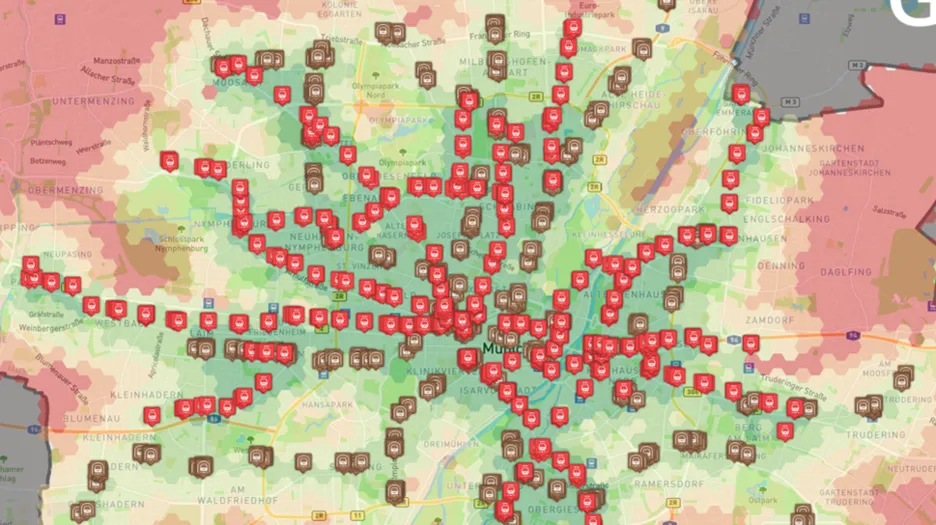
The GOAT 3.0 project is concerned with developing a web tool for carrying out spatial analyses for urban and transportation planning. The focus is on multimodal accessibility analyses, for example, to evaluate the quality of public transport accessibility or the local accessibility of essential facilities. The challenge here is to develop analyses that are easy to understand and carry out but, at the same time, relevant to actual planning issues. GOAT 3.0, therefore, follows a co-creative and iterative approach in which developments are repeatedly mirrored with users.
The development is based on the preliminary work of the predecessor project GOAT, which was also funded by mFUND. The original version specialized in pedestrian and bicycle traffic. GOAT 3.0 now also includes analyses for public transport and private transport. Specialized accessibility analyses have been integrated into the tool for public transport, above all, the ÖV-Güteklassen. In addition, classic accessibility indicators such as the travel time to the nearest x facilities have been added.
Aside from researching, conceptualizing and integrating accessibility indicators, data is also a major topic. On the one hand, the locations of services of general interest were collected throughout Germany, and algorithms for merging them were developed during the project. On the other hand, new algorithms for updating and disaggregating population at the building level were developed and tested. In addition, traffic data such as public transport timetables and actual car traffic speeds were collected and integrated into the tool.
To date, 14 user workshops with more than 70 participants, 42 usability tests and many other formats for the participation of experts and users have been used for development. In addition, GOAT is now being used in practice by several municipalities and regional associations as well as the project partner MVV. The results obtained are constantly being incorporated into the tool's development process. We are now in the final iteration, in which we want to move from the current version GOAT 2.0 to a final version GOAT 3.0.
Objectives
- Develop a digital planning tool (GOAT 3.0)
- Identify suitable spatial indicators for accessibility analyses
- Collect and data on transport networks, points of interests
- Develop algorithms to refine and process data from different sources
Contractor
Federal Ministry of Transport and Digital Infrastructure
Partners
Plan4Better GmbH (P4B)
Leibniz-Institut für ökologische Raumentwicklung (IÖR)
Prof. Schaller UmweltConsult (PSU)
Münchner Verkehrs- und Tarifverbund GmbH (MVV)
Duration
November 2021 – October 2024
Contact
Dr.-Ing. Benjamin Büttner (benjamin.buettner@tum.de, +49.89.289.2503)
M. Sc. Sebastian Seisenberger (sebastian.seisenberger@tum.de, +49 (89) 289 - 23833)